
Video

Google Maps now lets anyone upload Street View photos with just a phone
Latest Videos
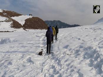
Amid dry winter in Kashmir, snow-clad Bangus Valley in Kupwara district emerges as winter wonderland

Grand welcome given to sculptor Arun Yogiraj at Bengaluru Airport

Injured WB CM Mamata Banerjee meets West Bengal Governor CV Anand Bose
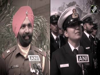
Couple set goals! Husband to lead Sikh Regiment, wife to command ICG contingent in R-Day Parade

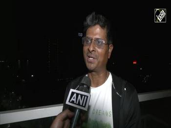
Inside India’s and Air India’s first Airbus A350 with luxurious seats, new interiors
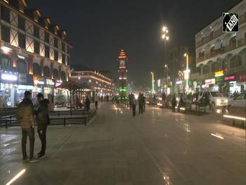
J-K: Srinagar’s Ghanta Ghar comes alive with spectacular Tricolour lighting
More Videos
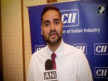
CII Health Summit | How AI can be useful in improving healthcare? Experts explain
New Delhi, July 19 (ANI): At the 3rd CII Digital Health Summit in New Delhi on July 19, industry experts talked about the usefulness of Artificial Intelligence (AI) in improving healthcare outcomes. “Where we stand at the crossroads of medicine and technology, I think it (AI) stands to transform the fabric of how medical care is actually delivered to patients today. We should actually embrace AI in a way to assist thousands of doctors in our country, especially in the country where last-mile delivery is an issue,” said the CEO of Dr Dangs Lab, Arjun Dang.

Google's Pixel Fold device's internal display to have 120Hz, 1200 nits brightness
New Delhi, Oct 17 (ANI): An exclusive report has uncovered a new set of specifications for American tech giant Google's upcoming foldable Pixel device. According to GSM Arena, the specs uncovered by developer Kuba Wojciechowsck were shared by 91Mobiles. It tells that the Google Pixel Fold (codenamed 'Felix') will feature dual displays (internal and external) and both will be manufactured by Samsung. The internal display will support a resolution of 1840 x 2208 (5:6 aspect ratio) and the dimensions listed are 123mm x 148mm. GSM Arena calculated the hypotenuse diagonal dimension of the display (192.44 mm), it measures 7.58 inches diagonally. As per Wojciechowski, the internal display will output a peak brightness of 1200 nits with an average brightness output of 800 nits. Although there's no certainty from the source, they say the display may support a 120Hz refresh rate. The same developer previously uncovered Felix's triple camera hardware, comprising a 64MP IMX787 main camera, a 12MP IMX386 ultrawide, and a 10.8MP S5K3J1 telephoto shooter, reported GSM Arena.

Samsung Galaxy S23 smartphone to get battery upgrade over predecessor
New Delhi, October 11 (ANI): South Korean tech giant Samsung's upcoming Galaxy S23 series' vanilla version smartphone will have a 3,900 mAh battery, which is an upgrade over the predecessor Galaxy S22. According to GSM Arena, this information comes from a reliable tipster Digital Chat Station. They also stated the screen will be 6.1" with Full HD+ resolution, which is essentially the same as the previous vanilla flagship, meaning Samsung managed to fit a bigger cell in the relatively small body.

Facebook reveals login credentials of over 1 million users stolen by malicious apps
New Delhi, Oct 09 (ANI): Meta, the parent company of Facebook has warned its users about hundreds of apps on Apple and Google's app stores that were specifically designed to steal login credentials to the social network app. According to The Verge, the company has said that over 400 malicious apps disguised as games, photo editors, and other utilities have been identified by them. Facebook is notifying users who "may have unknowingly self-compromised their accounts by downloading these apps and sharing their credentials”.
National Videos
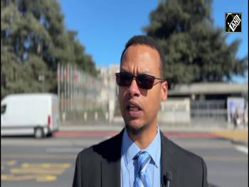
Northeast India’s growth highlighted at UN
In the sidelines of the 61st session of the United Nations Human Rights Council (UNHRC), Mazin Mukhtar, Co-founder and Associate Director of the Akshar Foundation, highlighted development initiatives in India’s northeastern region.
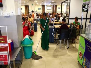
Ahmedabad Junction’s ₹20 AC Waiting Hall Sees Massive Response
At Ahmedabad Junction, popularly known as Kalupur Station, the newly introduced AC waiting hall is quickly gaining popularity. For just ₹20, over one lakh passengers have used the facility. In only three months, it has generated nearly ₹25 lakhs in revenue, highlighting strong demand and improved comfort for travelers.AC waiting hall has become a comfortable space for passengers to relax during their journey. It offers clean washrooms, newspapers, a canteen, and baby-care facilities. These amenities are especially helpful for families travelling with children, making the waiting time at the station more convenient and pleasant. Passengers are giving positive feedback, appreciating the comfortable facilities and clean environment available at an affordable price.
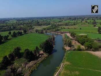
Hamirpur Celebrates Rebirth of Chandrawal River
Hamirpur (Uttar Pradesh), March 12 (ANI): Nestled in the Bundelkhand region of Hamirpur, the district is known for its fertile plains and hardworking farming communities. Blessed with rivers like the Yamuna River and the Betwa River, the region is now witnessing the remarkable revival of the Chandrawal River. Originating in Mahoba, the Chandrawal River flows nearly 68 kilometres through Hamirpur district, from Gram Panchayat Guda to Gram Panchayat Kaithi, before entering Banda where it ultimately merges with the Ken River. Once reduced to a polluted drain, the river has now been transformed into a symbol of environmental renewal. The revival was carried out under Mission Jalodaya and the Namami Gange Programme with active participation from local communities. The district administration divided the river into 19 sections, carried out desilting, removed waste, monitored industrial discharge, and ensured strict water quality testing. After months of dedicated work, the Chandrawal River was successfully rejuvenated in December 2025. Today it flows clean and vibrant, bringing life to more than two dozen villages. For farmers, the river has become a lifeline—providing irrigation water, enriching soil fertility, and boosting crop production. With community participation, ghat beautification, and large-scale plantation along the banks, the Chandrawal River now stands as a powerful example of sustainable development and collective action.
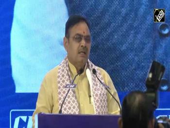
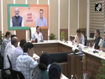
Rajasthan CM Bhajanlal Sharma attends CII Rajasthan session on $4.3 trillion economy vision
Jaipur (Rajasthan) March 2026 (ANI): Rajasthan Chief Minister Bhajanlal Sharma addressed the Rajasthan State Annual Session 2025-26 organized by the Confederation of Indian Industry in Jaipur.
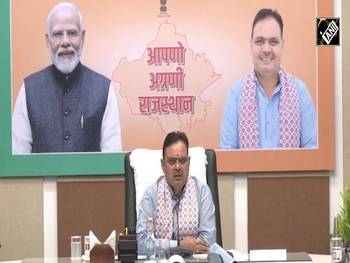
एलपीजी की जमाखोरी व कालाबाजारी पर होगी सख्त कार्रवाईः मुख्यमंत्री भजनलाल शर्मा
जयपुर, राजस्थान 12 मार्च, 2026, (एएनआई): मुख्यमंत्री भजनलाल शर्मा ने जयपुर स्थित मुख्यमंत्री निवास पर राज्यवासियों को निर्बाध एलपीजी आपूर्ति के संबंध में महत्वपूर्ण बैठक बुलाई। इस दौरान मुख्यमंत्री ने कहा कि प्रदेश में एलपीजी आपूर्ति पूरी तरह सामान्य है, और एलपीजी की जमाखोरी व कालाबाजारी पर सख्त कार्रवाई होगी। उन्होंने एलपीजी गैस आपूर्ति को लेकर निर्देश दिए कि आपूर्ति व्यवस्था को निर्बाध बनाए रखने के लिए उपलब्धता से लेकर वितरण व्यवस्था की निगरानी रखते हुए प्रभावी प्रबंधन सुनिश्चित किया जाए। इसके लिए राज्य और जिला स्तर पर कंट्रोल रूम स्थापित किए जाएं। उन्होंने नागरिक आपूर्ति को सर्वाेच्च प्राथमिकता देते हुए खाद्य और नागरिक आपूर्ति विभाग के कार्मिकों के अवकाश निरस्त किए जाने के निर्देश दिए। मुख्यमंत्री ने कहा कि आम उपभोक्ताओं को किसी प्रकार की परेशानी नहीं हो। इसके लिए एलपीजी गैस और पेट्रोलियम उत्पादों की जमाखोरी या कालाबाजारी पर विशेष निगरानी रखी जाए। उन्होंने निर्देश दिए कि जिलाकलेक्टर और संबंधित अधिकारी निरीक्षण कर निरंतर मॉनिटरिंग करें।

हमीरपुर में चंद्रावल नदी का पुनर्जन्म
हमीरपुर (उत्तर प्रदेश), March 12 (ANI): बुंदेलखंड के हमीरपुर जिले में चंद्रावल नदी का पुनर्जीवन जल संरक्षण और सामूहिक प्रयास की एक प्रेरणादायक कहानी बनकर सामने आया है। कभी गंदे नाले में बदल चुकी यह नदी आज फिर से स्वच्छ, निर्मल और जीवनदायिनी रूप में बह रही है। महोबा से निकलकर हमीरपुर के ग्राम पंचायत गुड़ा से लगभग 68 किलोमीटर की यात्रा तय करते हुए यह नदी ग्राम पंचायत कैथी तक पहुँचती है और आगे जनपद बांदा में केन नदी में मिल जाती है। मिशन जलोदय और नमामि गंगे परियोजना के तहत जिला प्रशासन ने स्थानीय समुदाय की सक्रिय भागीदारी के साथ इस नदी को पुनर्जीवित करने का महत्वपूर्ण कार्य किया। कई महीनों के श्रमदान, सफाई अभियान, घाटों के सौंदर्यीकरण और नदी किनारे वृक्षारोपण के बाद दिसंबर 2025 में चंद्रावल नदी को नया जीवन मिला। आज यह नदी दो दर्जन से अधिक गांवों के लिए नई उम्मीद बन चुकी है। किसानों को सिंचाई के लिए स्वच्छ जल मिल रहा है, मिट्टी की उर्वरता बढ़ रही है और खेत फिर से हरियाली से लहलहा रहे हैं। चंद्रावल नदी का पुनर्जीवन इस बात का प्रमाण है कि प्रशासन और जनता के सामूहिक प्रयास से पर्यावरण संरक्षण और सतत विकास का सपना साकार किया जा सकता है।
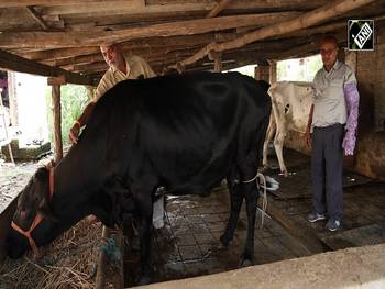
Gujarat’s Dairy Hero: Deepak Patel and the Science of Better Breeding
In India’s vast dairy sector, 63-year-old Deepak Patel from Vaheval village in Gujarat has brought a remarkable change through scientific breeding practices. With an impressive 80% success rate, he has performed more than 80,000 artificial insemination procedures, helping improve cattle genetics and increase milk production. His work has significantly supported farmers in the Mahuva region by boosting livestock productivity and strengthening their livelihoods. Even at 63, Deepak Patel continues his mission with dedication, empowering farmers and contributing to the growth of India’s dairy sector while inspiring hope for stronger rural prosperity.
Rajasthan CM Bhajanlal Sharma holds ‘crucial’ meeting on LPG & Petroleum supply at CMR
Jaipur (Rajasthan): March 11, 2026: (ANI): Rajashthan Chief Minister Bhajanlal Sharma held a high-level meeting to ensure uninterrupted gas and petroleum supplies in the state amid the current international situation. Officials from various departments and heads of Indian Oil, BPCL, HPCL, and Torrent Gas attended. The meeting canceled Food & Civil Supplies staff leaves and directed strict action against black marketing.
World Videos
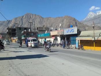
Security deployment, curfew expose governance crisis in PoGB
PoGB, 11 March 2026: Tension continues in Pakistan-occupied Gilgit-Baltistan, where a recently imposed strict curfew and heavy deployment of security forces disrupted normal life. Authorities had handed control of several areas to security personnel in an attempt to contain unrest following the death of Iranian Leader Ayatollah Khomeini, leaving residents struggling to access essential goods and services. Although restrictions are now partially eased, the situation in the region remains tense. Daily wage labourers have been among the worst affected, as many rely on daily earnings to support their families. During the strict curfew, residents also expressed frustration over the closure of markets and the difficulty in accessing essential supplies. The developments once again raised concerns about the governance of illegally occupied regions in Pakistan. Instead of addressing public concerns, the imposition of curfew and heavy security presence restricted movement and disrupted livelihoods, leaving residents struggling to manage daily necessities. Pakistan often fails to adequately address the concerns of ordinary citizens, particularly in the illegally occupied regions of Pakistan-occupied Jammu and Kashmir (PoJK) and Pakistan-occupied Gilgit-Baltistan. Instead of addressing public grievances through dialogue and development, authorities often rely on administrative crackdowns. As a result, locals often feel that their basic needs and rights are overlooked, deepening frustration and highlighting long-standing governance challenges in these regions.

Watch! Latest visuals emerge as Middle-East situation worsen amid escalating Iran-Israel war
New Delhi, March 07, 2026 (ANI): Latest visuals emerged as Middle-East situation worsen amid escalating Iran-Israel war. Missiles and interceptions light up the skies over the West Bank and Jerusalem, while sirens and incoming rockets terrorise Tel Aviv during the night. In Iraq, a U.S. asset is seen engulfed in flames after a drone strike, and tensions surge in Erbil following another drone attack on civilian infrastructure. Meanwhile, in Tehran, fires and thick smoke rise across the city as overnight strikes continue amid the escalating Iran–Israel conflict.

Kyoto hosts cooking test to certify foreign Japanese cuisine chefs
Kyoto (Japan), March 04 (ANI): Cooking test to certify real qualification for foreign Japanese cuisine chefs was held in Kyoto. Under global trend of Japanese cuisine, Japanese Cuisine and Dietary Culture Development Committee (JCDC) organized cooking skill test to certify real Japanese cuisine qualification for foreign chefs. 12 foreign chefs applied to it aiming gold or silver qualification. Some of chefs got training in Japanese traditional restaurant. Others got win in the Japanese cuisine championship event held by Ministry of Agriculture Forestry and Fisheries. 10 chefs applied to silver qualification test cooking 1 soup and 5 plates. 2 chefs applied to gold qualification test cooking Shokado bento box. Those disciples keep in the mind mentor’s message “Each country has each taste defined by temperature and air pressure. Please adapt to them to complete most taste Japanese cuisine for your country.
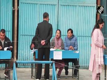
People of Nepal, leaders vote to elect new government after Gen-Z ptotest | Nepal General Elections
Kathmandu (Nepal), March 05, 2026 (ANI): Locals in Nepal expressed hope that the new government formed after the 2026 general election will focus on the country’s development and work to improve the lives of its people. Voting is underway across thousands of polling centres as citizens participate in choosing their next government.

Nepal: Thousands of voters leave Kathmandu ahead of Polls
Kathmandu (Nepal), March 03 (ANI): Thousands of voters have begun leaving Nepal’s capital, Kathmandu, to return to their home districts ahead of Thursday’s crucial elections in the Himalayan nation. Visuals from Koteshwor Bus Park show hundreds of people carrying luggage and boarding vehicles as the country enters the final phase of poll preparations. According to Traffic Police records, more than 300,000 people have already departed the capital by road to cast their votes. The number is expected to double as polling day approaches. The election comes six months after the nationwide Gen-Z protest. Campaigning has officially ended, and the mandatory two-day silence period is now in effect. Under the Election Code of Conduct, campaign materials within 300 metres of polling stations must be removed, and political promotion across social media, print and electronic platforms is prohibited. Authorities have also imposed restrictions on public gatherings, processions and crowd-creating activities 48 hours before voting to ensure a free and fair electoral process.

PoJK: Health workers protest in Muzaffarabad over ending allowance demands
Health department employees in Pakistan-occupied Jammu and Kashmir staged a strike at the Abbas Institute of Medical Sciences (AIMS) in Muzaffarabad to press the government for acceptance of their long-pending demands. Due to the protest, outpatient department (OPD) services were temporarily closed, causing inconvenience to patients and hospital visitors. Protesters gathered inside and outside the hospital premises, raising slogans and demanding immediate action on their Charter of Demands, which they say has remained unresolved despite repeated assurances from authorities. The protesters maintained that their demands are clear and need immediate implementation rather than prolonged deliberation. They voiced frustration that despite the passage of nearly a month, the government has taken no concrete steps. The protest has once again exposed what employees describe as deep governance failures and a persistent pattern of delayed decision-making in Pakistan-occupied Jammu and Kashmir. Despite formal meetings, verbal commitments, and negotiated agreements, implementation on the ground remains stalled, reflecting weak administrative follow-through and institutional inefficiency.
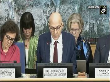
UN Rights chief praises India’s civil society
Geneva (Switzerland), March 02 (ANI): Volker Türk, United Nations High Commissioner for Human Rights, praised the vibrancy of India’s civil society after his recent visit, calling it a vital pillar of democratic life and important for protecting minority rights. He said it is crucial that civic space be strongly defended so that civil society can work without hindrance. Speaking at the UN Human Rights Council session in Geneva, Türk also highlighted troubling developments globally. He noted that lawyers and human rights defenders in Pakistan have been jailed over critical social media posts, expressed regret over restrictions on civic space in Georgia, and welcomed the release of some detainees in Venezuela while urging authorities to free others still in detention.
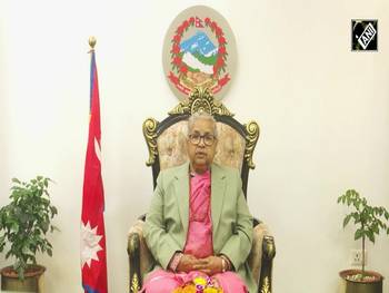
Nepali Interim PM urges voters to participate ahead of Thursday’s silence period
Kathmandu (Nepal), March 02 (ANI): Nepal’s interim Prime Minister Sushila Karki has called on the voters to take part in March 5 election for House of Representatives. Addressing the nation on Monday afternoon, Karki said Nepal stood at a “historic and important juncture” and appealed to citizens to cast their ballots. Karki was appointed as the Interim Prime Minister on September 12 after days of deliberation following the September 8 protest. Karki urged political parties and candidates to maintain discipline, especially during the silence period, and thanked the Election Commission, security agencies and civil servants for their preparations to ensure free and fair polls. Concluding her address, Karki said she had assumed office at a difficult moment and that the country’s direction would soon rest with the people’s chosen representatives.
Entertainment Videos
‘Subedaar’ actor Aditya Rawal calls father Paresh Rawal a versatility icon
Mumbai, 7TH March 2026 (ANI): ‘Subedaar’ actor Aditya Rawal calls father Paresh Rawal a versatility icon
Siddhant Chaturvedi & Mrunal Thakur shares their manifesting role on 'Do Deewane Seher Mein'
Mumbai, Feb 13, 2026 (ANI): Siddhant Chaturvedi and Mrunal Thakur's upcoming romantic movie 'Do Deewane Seher Mein' is all set to hit theatres this month, bringing to the audience an "isq-bhari" story. Actor Siddhant Chaturvedi, who plays the lead male character, opened up on how he came on board for the project. Directed by Ravi Udyawar, Zee Studios and Bhansali Productions present 'Do Deewane Seher Mein'. The film is produced by Sanjay Leela Bhansali, Prerna Singh, Umesh Kumar Bansal and Bharat Kumar Ranga in association with Ravi Udyawar Films. 'Do Deewane Seher Mein' is slated for a theatrical release on February 20.
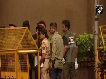
BREAKING: 4 round fired outside Director Rohit Shetty’s residence, police start probe
Mumbai, 01 Feb 2025 (ANI): | Police and forensic teams reach Director Rohit Shetty's residence, after an incident of firing was reported outside his residence. Further details awaited.
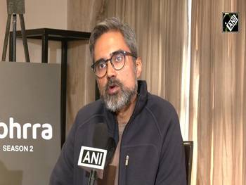
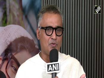
‘Kohrra 2’ cast Mona Singh, Rannvijay Singha, Barun Sobti on how OTT transformed storytelling
New Delhi, 30 Jan 2026 (ANI): In this video, Kohrra 2 cast members Mona Singh, Rannvijay Singha, and Barun Sobti share insights on how OTT platforms have transformed storytelling in India. They talk about deeper characters, bold narratives, and the creative freedom streaming platforms offer actors and creators.
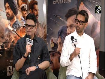
‘Gadar 2 fueled Border 2…’ Producer Bhushan Kumar, Director Anurag Singh on cast, future, more
Mumbai, Jan 25, 2025: (ANI): In an Exclusive Interview Producer Bhushan Kumar and Director Anurag Singh speak on newly released film Border 2.
Top film critic, trade analyst exposes dynamics of fake PR, predicts future of Hindi films in 2026
Top film critic, trade analyst exposes dynamics of fake PR, predicts future of Hindi films in 2026

Watch: Rani Mukherjee gets emotional recalling Karan Johar’s heartwarming gesture
Mumbai (Maharashtra) 23 Jan 2026 (ANI): Rani Mukherjee got emotional while recalling a heartwarming gesture by filmmaker Karan Johar. The video captures an intimate moment as the actress shares her feelings, reflecting on their long-standing bond and emotional support within the film industry. The clip highlights friendship, gratitude, and behind-the-scenes Bollywood moments.
Actor Sunil Shetty shares mixed emotions ahead of son Ahan Shetty’s ‘Border 2’ release
Mumbai (Maharashtra) 23 Jan 2026 (ANI): Actor Sunil Shetty shared mixed emotions ahead of the release of his son Ahan Shetty’s upcoming film Border 2. The veteran actor spoke about pride, nervousness, and expectations as Ahan steps into a major phase of his career. The video captures Bollywood buzz, family sentiments, and growing anticipation around the film’s release.
Business Videos
Sensex-Nifty open red, skids over 2,500 points amid Iran crisis; what it means for retail investors?
Mumbai (Maharashtra) March 02, 2026 (ANI): India’s benchmark indices — the BSE Sensex and Nifty 50 — opened sharply lower on Monday, March 02, amid escalating tensions between Iran and Israel. The BSE Sensex opened at 78,543, down 2,743 points from its previous close, while the Nifty-50 opened at 24,659, slipping nearly 519 points in early trade as global markets reacted to geopolitical uncertainty. Market expert Sunil Shah said that uncertainty over the duration of the crisis triggered negative reactions worldwide. He warned that if crude oil prices surge further, India may face a significant economic impact.

SEBI Chief Tuhin Kanta Pandey speaks on ‘Jane Street’ crackdown and enhanced surveillance measures
SEBI Chief Tuhin Kanta Pandey speaks on ‘Jane Street’ crackdown and enhanced surveillance measures
Impact of Middle East crisis! Will retail investors feel safe investing in IPOs? SEBI Chief Explains
Impact of Middle East crisis! Will retail investors feel safe investing in IPOs? SEBI Chief Explains

Gautam Adani visits Baba Baidyanath temple in Deoghar, performs darshan and offers prayers
Deoghar (Jharkhand) 22 Feb 2026 (ANI): Adani Group Chairman Gautam Adani arrived at the historic Baba Baidyanath Dham in Deoghar, Jharkhand, on February 22, 2026, where he offered prayers and performed darshan at the revered Jyotirlinga shrine.

“Increase export…” Auto Industry expert Bagga outlines industry roadmap after trade deal with US
New Delhi, Feb 12, 2026 (ANI): Gurbani Bagga (Partner, Boston Consulting Group) On Automobile Sector, India-Eu Fta, India-Us Trade Deal
Distilleries Association seeks GST cuts on flex-fuel vehicles to boost in domestic demand
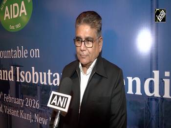
New Delhi, Feb 10, 2026 (ANI): The central argument is valid: the ethanol industry is seeking GST cuts on flex-fuel vehicles to boost demand after India achieved the E20 blending target early, leading to surplus ethanol capacity. However, most widely reported demands for GST rationalisation have come from ISMA, and there is limited independent media confirmation of AIDA leading this push in the way described. AIDA is a recognised industry body, and its broader advocacy on ethanol, bio-refineries and alternative green fuels aligns with current policy discussions.
‘75 years old relation, beautiful Country…’ Sibi George hails India‑Iran Bilateral Ties
New Delhi, February 9, 2026 (ANI): Highlighting the longstanding friendship between India and Iran, MEA Secretary West, Sibi George, praised the 75-year-old bilateral ties, calling Iran a ‘beautiful country.’
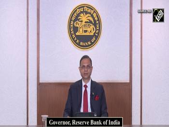
Monetary Policy Committee keeps the repo rate unchanged at 5.25%: RBI Governor Sanjay Malhotra
Reserve Bank of India Governor Sanjay Malhotra on Friday also announced a set of measures aimed at enhancing customer protection, advancing financial inclusion, enhance flow of credit, strengthening urban cooperative banks (UCBs), promoting ease of doing business for NBFCs, and deepening financial markets. For customer protection, the governor proposed issuing three draft guidelines: one on mis-selling; two on the recovery of loans and the engagement of recovery agents; and three on limiting customer liability for unauthorised electronic banking transactions. It has also been proposed to introduce a framework to compensate customers up to Rs 25,000 for losses incurred in small-value fraudulent transactions. In the monetary policy statement, he announced that the RBI will also publish a discussion paper on potential measures to enhance the security of digital payments.
Sports Videos
T20 World Cup IND vs PAK: Lt Gen KJS Dhillon roasts Pakistan after India’s thundering win
16 Feb 2026 (ANI): Watch veteran KJS Dhillon roast Pakistan after India’s thundering win over Pakistan in the T20 World Cup 2026. India dominated with a sensational performance, leaving fans thrilled and Pakistan stunned. Full post-match reactions, highlights, and cricket drama included. Perfect for fans of IND vs PAK rivalry and T20 World Cup action.
Ishan Kishan scores 77 off 40, coach Uttam Mazumdar hails him, saying India’s morale soars
Kolkata, February 16, 2026 (ANI): Team India wicket-keeper batter Ishan Kishan's coach, Uttam Mazumdar, says, "I'm so happy. He scored 77 runs in 40 balls. This is truly commendable, and I want to thank Ishan. Today, the entire country is very happy. This win was very important to raise Team India's morale in the World Cup. I'm very happy..."

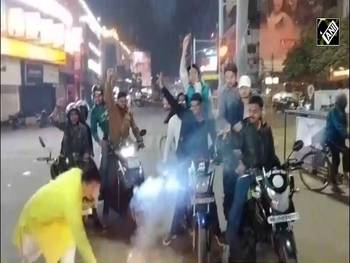
Indian fans erupt nationwide as Team India defeats Pakistan in ICC T20 World Cup 2026 clash
February 16, 2026 (ANI): As Team India defeated their formidable rivals Pakistan in the ICC T20 World Cup 2026 group-stage match, fans across the country erupted in celebration.
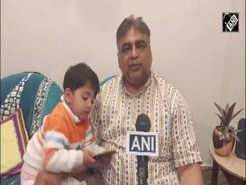
Ishan Kishan’s parents ‘beam with pride’ after son’s powerful knock against Paksitan in T20I WC 2026
Patna (Bihar), February 16, 2025: (ANI): Ishan Kishan’s parents expressed happiness after son’s powerful knock against Paksitan in T20I WC 2026
ICC T20 World Cup! This is how Pakistan takes full U-turn to play match with India, BCCI VP explains
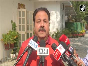
New Delhi, Feb 10, 2026 (ANI): On Pakistan to play against India at T20 cricket World Cup, BCCI Vice-President Rajeev Shukla said, “I am delighted to see the outcome of the deliberations initiated by ICC representative, supervised by the ICC Chairman and the representatives who had gone to Lahore to talk to Pakistan Cricket Board as well as Bangladesh Cricket Board. It's a good solution, an amicable solution which has been found to give priority to cricket's importance in the game. This is what has been done. So all kudos to ICC for taking this initiative, resolving the whole issue and bringing cricket back to the forefront. This is a big achievement as far as ICC is concerned. So I would like to thank ICC for taking this initiative and bringing Pakistan to the table, ultimately deciding for Pakistan to play in the Colombo match. It's good news for all of us and the scheduled match for 15th February in Colombo will take place. Pakistan will also play. So now this World Cup will also be a big success story. Bangladesh's feelings have also been assaged as far as these negotiations are concerned, and some relief has been given to their board, and they are also happy. In fact, they have praised ICC for its efforts. It's a win-win situation for everybody and I'm happy that the match would take place and World Cup will be a successful event,” said Rajeev Shukla.

WATCH: Gautam Gambhir hosts a ‘special’ dinner for members of the Indian T20 cricket team
New Delhi, February 09, 2026(ANI): Members of the Indian T20 cricket team arrive at the residence of Indian Cricket Team Head Coach Gautam Gambhir in Delhi. Gautam Gambhir is hosting a special dinner for the team

India beats USA by 29 runs in ICC T20 World Cup 2026 opener
India beats USA by 29 runs in ICC T20 World Cup 2026 opener

Fans cheer as Team India crushes New Zealand, winning T20I series 4-1 with a massive victory
Thiruvananthapuram (Kerala), February 1, 2026: (ANI): In the final clash of the five-match T20I series on January 31, 2026, Team India thrashed New Zealand by 46 runs, setting a massive target of 272. With this emphatic win, the Men in Blue secured the series 4-1. Fans expressed their excitement and joy to ANI, celebrating India’s dominant performance.
Copyright © aninews.in | All Rights Reserved.